

Umphang Travel Guide
Umphang Overview

Umphang is a remote mountain district in Tak Province, western Thailand, best known for Thi Lo Su Waterfall, Mae Klong River rafting, mist-covered viewpoints and some of the country’s most important forest habitat. The district borders Myanmar and is surrounded by rugged mountains, river valleys and protected forest, giving it a very different character from Thailand’s more accessible northern destinations.
The main settlement sits in a mountain valley at roughly 500 meters above sea level. Umphang is small and quiet, and travelers primarily use the town as a base for nature trips rather than urban sightseeing. The journey itself is part of the destination: the main access road from Mae Sot is Highway 1090, a 164-kilometer mountain route famous for its 1,219 bends.
Most first-time visitors come for a classic combination of Thi Lo Su Waterfall, rafting on the Mae Klong River and sunrise at Doi Hua Mot. More experienced trekkers can plan separate multi-day expeditions to Pi Tu Gro, also known as Pre-Toh Lo Su, and Doi Mamuang Sam Muen during the green season.
Umphang suits travelers who enjoy remote landscapes, outdoor activity and slow travel. It requires more planning than a conventional Thailand travel guide because road conditions, sanctuary rules, rainfall and seasonal attraction closures can directly affect what is possible.
How Many Days Do You Need in Umphang?
| Trip Length | What You Can Realistically Do |
|---|---|
| 1 night | Mostly transit. Too rushed for a worthwhile first visit. |
| 2 nights / 3 days | Best minimum trip: travel from Mae Sot, Thi Lo Su and Doi Hua Mot. |
| 3 nights / 4 days | More relaxed Thi Lo Su trip, rafting, Doi Hua Mot and time in Umphang town. |
| 4-5 days | Add community-based activities, secondary viewpoints or additional nature routes. |
| 3 days / 2 nights for Pi Tu Gro alone | Separate trekking expedition for experienced hikers, normally with guide and porter support. |
Umphang should not normally be treated as a day trip from Mae Sot. The mountain road is long enough that spending at least two nights in the district produces a much safer and more rewarding itinerary.
Umphang Weather and Best Time to Visit
November to February is the easiest overall period for a first trip to Umphang, but the best season depends on the activity you want to prioritize. Thi Lo Su, Doi Hua Mot and Pi Tu Gro have different seasonal strengths.
Thai Meteorological Department climate normals for the Umphang weather station, located at an elevation of 454 meters, show a marked dry and wet season. January has an average temperature of about 20.5°C, while April averages about 26.2°C. Average nighttime lows fall to around 12.9°C in January and 13.9°C in December, which explains why pre-dawn viewpoint trips can feel surprisingly cool.
| Period | Best For | Main Trade-Off |
|---|---|---|
| Sep-Oct | Powerful waterfalls, green forest, rare seasonal plants | Rain, wet trails and higher road-disruption risk |
| Nov-Feb | Best overall road conditions, Thi Lo Su, Doi Hua Mot, general trekking | Popular nature-travel period |
| Mar-Apr | Drier roads and some hiking | Hot afternoons, wildfire smoke and haze can reduce comfort |
| May-Jun | Increasingly green scenery | Rain becomes more frequent |
| Jul-Aug | Pi Tu Gro and specialized wet-season trekking | Very wet; Thi Lo Su may close for seasonal recovery |
November to February: Best Overall Conditions
The dry season in Thailand gives most first-time Umphang visitors the simplest logistics. Roads are generally easier, river and trekking conditions are more predictable and humidity is lower.
December and January are particularly comfortable for outdoor activity, but carry a light jacket for Doi Hua Mot before sunrise. Umphang’s local climate is cooler at night than the lowlands around central Tak.
September and October: Maximum Nature Intensity
September and October are particularly interesting for travelers willing to accept wetter conditions. Thi Lo Su reopens after its seasonal recovery closure, the waterfall carries strong post-monsoon flow and the surrounding forest is intensely green.
This is also the period when rare plants around Doi Hua Mot can become an attraction in their own right. In 2026, local tourism and conservation teams highlighted the tiny Pisawong Tan Nok Hook plant and butterfly-wing balsam flowers as seasonal nature experiences.
The trade-off is weather. September is one of Umphang’s wettest months, so landslides, temporary road restrictions and muddy trails remain possible. Travelers visiting during the rainy season in Thailand should keep more flexibility in the itinerary.
March and April: Heat and Haze
April has the highest average daytime temperatures in the local climate normals, with mean maximum temperatures around 34.9°C. Late dry season can also bring regional wildfire smoke and reduced visibility.
If traveling during this period, start activities early, carry enough drinking water and check current air-quality conditions before planning long hikes.
How to Get to Umphang
Mae Sot is the practical gateway to Umphang. There is no passenger railway to Umphang and the town does not have scheduled commercial flights, so the final journey is by road.
Bangkok to Mae Sot
Mae Sot Airport is currently active and, in September 2026, nonstop flights are operating between Bangkok Don Mueang and Mae Sot. Flight schedules can change, so travelers should confirm the current service when booking rather than relying on an old timetable.
Long-distance bus services also connect Bangkok with Mae Sot. Flying saves substantial time if Umphang is the main purpose of the trip.
Chiang Mai to Mae Sot
Travelers from Chiang Mai should currently plan on an overland connection to Mae Sot rather than assuming that a nonstop Chiang Mai-Mae Sot flight operates. Transport schedules change, but bus, minivan and private-road transfers are the more dependable planning options.
Mae Sot to Umphang
From Mae Sot, Highway 1090 covers approximately 164 kilometers before reaching Umphang. Umphang municipality estimates private vehicles can make the journey in roughly two to three hours in favorable conditions, while public transport may take four to five hours.
For international travelers unfamiliar with the road, planning around four hours or more is sensible. Weather, construction, rest stops, traffic and motion sickness can all extend the journey.
A private car with driver in Thailand can be especially useful for families, older travelers and visitors who do not want to drive a demanding mountain road themselves.
Driving Highway 1090 and Its 1,219 Curves
Highway 1090 is one of Umphang’s defining travel experiences, but it deserves respect rather than being treated simply as a scenic road.
The paved route climbs repeatedly through mountain terrain between Mae Sot, Phop Phra and Umphang. Umphang municipality officially promotes the famous figure of 1,219 curves, and travelers prone to motion sickness should prepare before departure.
- Motion sickness: take medication in advance if you normally become carsick.
- Avoid rushing: allow time for breaks and do not build a tight connection around your arrival.
- Refuel before remote sections: do not wait until the tank is nearly empty.
- Wet-season driving: rain can trigger landslides, falling trees or temporary lane restrictions.
- Night driving: visitors unfamiliar with the route are better off completing the mountain section in daylight.
- Check current conditions: Thailand’s Department of Highways hotline 1586 is useful before travel after prolonged rain.
The road remains an active transport corridor and is undergoing maintenance in 2026. Department of Highways documentation lists asphalt rehabilitation on sections of the Huai Nam Rin-Umphang route. Recent heavy-rain events also demonstrate why road-condition checks matter: a landslide in late August 2026 damaged part of Highway 1090, and national water authorities included Umphang in a flash-flood and landslide risk warning for September 9-13.
This does not mean the road is normally impassable. It means a remote mountain itinerary should not assume road conditions are fixed throughout the wet season.
Thi Lo Su Waterfall
Thi Lo Su is Umphang’s signature attraction and one of Thailand’s largest and most celebrated waterfalls. It lies inside Umphang Wildlife Sanctuary, where several streams spill across a broad limestone and forested escarpment.
Tourism Authority of Thailand material describes the cascade at roughly 300 meters high and 500 meters wide. Because waterfall measurements vary according to definition and season, it is safer to describe Thi Lo Su as one of Thailand’s largest waterfalls rather than claiming an uncontested national size ranking.
Water volume changes dramatically through the year. Around September and October, the post-monsoon cascade is broad, powerful and surrounded by intensely green forest. Later in the dry season, access becomes easier but the falls can carry less water.
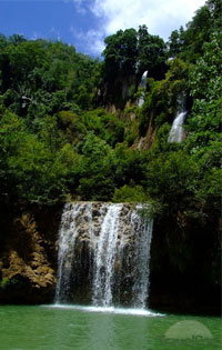
Waterfalls and forest streams shape the wider Umphang landscape, although Thi Lo Su itself is much larger than this smaller cascade.
Thi Lo Su Current Opening Status and Fees
Thi Lo Su reopened to visitors on September 1, 2026 following its rainy-season recovery closure. Before reopening, the Department of National Parks, Wildlife and Plant Conservation reported route improvements, emergency-response preparation and staff deployment at risk points.
| Current Detail | September 2026 Information |
|---|---|
| Visitor status | Open from September 1, 2026 after seasonal closure |
| Thai adult admission | 30 THB |
| Thai child admission | 20 THB |
| Foreign adult admission | 400 THB |
| Foreign child admission | 200 THB |
| Vehicle fee | 60 THB per car |
| Day visitor advance booking | Currently not required |
| Overnight visit | Advance permission and registration required |
| Published entry period | 08:00-15:00 |
| Day visitors | Reach the ticket point before 14:00 |
| Overnight visitors | Reach the ticket point before 16:30 after arranging permission |
These are operational details rather than permanent rules. Seasonal closures, admission arrangements and road access should be reconfirmed for travel well after 2026.
Day Trip or Overnight at Thi Lo Su?
For most first-time visitors, a day excursion from Umphang town is the simplest option. Overnight stays suit photographers and travelers who want more time inside the sanctuary, but facilities are basic and advance permission is required.
| Option | Best For | Trade-Off |
|---|---|---|
| Day trip from Umphang | Most first-time visitors | Long activity day |
| Sanctuary camping | Photographers, slower nature trips | Basic facilities and advance permission |
| Stay in Umphang town | Comfort, restaurants and easier logistics | Requires transfer to and from the sanctuary |
How to Reach Thi Lo Su
Thi Lo Su is not a simple roadside waterfall. The classic journey can combine a rubber-raft trip on the upper Mae Klong River with road transport and a final walking trail.
Tourism Authority of Thailand describes the established adventure route as roughly:
Umphang area → Mae Klong River rafting → Thi Lo Cho Waterfall → natural hot spring → road transfer → 1.5-kilometer nature trail → Thi Lo Su.
The traditional river section takes about three hours, followed by approximately 14 kilometers of road access and the final 1.5-kilometer walk. Exact routing can change according to river level, road conditions and sanctuary management, so use a current local operator or sanctuary arrangement rather than assuming every season follows the same transport pattern.
Thi Lo Su Rules for Responsible Visitors
Umphang Wildlife Sanctuary applies stronger conservation rules than an ordinary sightseeing attraction. Current reopening guidance asks visitors to:
- avoid bringing single-use plastic waste into the sanctuary;
- keep noise low;
- avoid disturbing wildlife;
- follow ranger instructions and designated routes;
- carry all rubbish out of natural areas;
- respect temporary closures or safety restrictions.
The rules are part of the site’s operating system, not optional etiquette.
Mae Klong River Rafting, Thi Lo Cho and Hot Springs
Rafting on the upper Mae Klong River turns the journey to Thi Lo Su into one of Umphang’s strongest experiences. The river winds between forest, limestone cliffs and smaller waterfalls before travelers continue overland toward the sanctuary.
Thi Lo Cho Waterfall
Thi Lo Cho, sometimes described as the rain or rainbow waterfall, appears along the rafting corridor. Water drops and sprays from the forested cliff, and sunlight can create rainbow effects in the mist when conditions align.
Thi Lo Cho works best as part of the rafting journey rather than as a standalone destination requiring a separate day.
Natural Hot Spring
A natural hot-spring area is another traditional stop on the river route. It provides a useful break during the longer journey and reinforces how varied the landscape is, combining forest, limestone, waterfalls and geothermal water within one adventure corridor.
Travelers specifically interested in active outdoor trips can connect Umphang with broader trekking experiences in Thailand, but remote Umphang routes require more guide support and seasonal planning than many mainstream trails.
Doi Hua Mot: Sunrise, Sea of Mist and Rare Plants
Doi Hua Mot is the best easy-to-combine viewpoint around Umphang and is particularly popular at sunrise. Its open limestone ridges and low vegetation create broad views across layers of mountain terrain that differ from the dense forest around Thi Lo Su.
A classic itinerary visits Thi Lo Su during one day, then leaves Umphang before dawn the following morning for Doi Hua Mot.
Best Season for Mist
Umphang’s climate records support the cool-season reputation of the viewpoint. November and December have particularly favorable climatological conditions for morning fog, while December through February also provides cooler pre-dawn temperatures.
Carry a light jacket, arrive before sunrise and allow time after dawn. The landscape can change quickly as the fog lifts from the valley.
Green-Season Wildflowers and Pisawong Tan Nok Hook
Doi Hua Mot also has a completely different appeal in the wet season.
In August 2026, local tourism and conservation teams documented the seasonal appearance of Pisawong Tan Nok Hook, a tiny rare plant whose unusual form resembles owl eyes. It is difficult to spot because of its size and grows close to the forest floor.
The 2026 observation season was expected to continue approximately into October, depending on rain and local conditions. Butterfly-wing balsam flowers are another seasonal feature promoted around the Doi Hua Mot landscape.
Visitors searching for the tiny plants must be especially careful. Do not pick, touch, step on or move them. Using a phone or camera zoom is better than walking off route for a close-up photograph.
Pi Tu Gro: Umphang’s Green-Season Trek
Pi Tu Gro, also called Pre-Toh Lo Su, is a separate adventure from Thi Lo Su and should not be treated as an easy waterfall add-on. Its two streams meet in a distinctive heart-shaped formation during high-flow conditions.
Tourism Authority of Thailand classifies the combination of Pi Tu Gro and Doi Mamuang Sam Muen as a serious multi-day trekking route.
| Attribute | Pi Tu Gro / Doi Mamuang Sam Muen |
|---|---|
| Main season | Approximately June-October |
| Strong waterfall period | Usually August-September |
| Typical trip length | 3 days / 2 nights |
| Pi Tu Gro trail | About 7 km |
| Doi Mamuang Sam Muen extension | About 3 km |
| Waterfall hike | Roughly 4-6 hrs depending on conditions |
| Mountain section | Roughly 4-5 hrs depending on route and conditions |
| Guide | Local guide support strongly required |
The route involves mud, stream crossings, steep ground and camping. It is best for fit travelers comfortable with consecutive days of wet-season hiking.
For a first Umphang visit, prioritize Thi Lo Su and Doi Hua Mot. Choose Pi Tu Gro when trekking itself is the main purpose of the journey.
Umphang Wildlife Sanctuary and the Western Forest Complex
Umphang Wildlife Sanctuary is one of the major protected forests of western Thailand, but it should not be described as a UNESCO World Heritage Site in its own right.
The UNESCO-listed property is officially the Thungyai-Huai Kha Khaeng Wildlife Sanctuaries. It covers 622,200 hectares and consists of two component sanctuaries: Thung Yai Naresuan and Huai Kha Khaeng.
Umphang Wildlife Sanctuary is a separate protected area within the wider Western Forest Complex and contributes to ecological connectivity between major forest blocks. This distinction matters because older travel descriptions sometimes blur the legal boundaries of the UNESCO property.
Tiger Conservation in Umphang
One of the most significant conservation updates came in September 2026. Camera-trap monitoring by Thailand’s Department of National Parks, Wildlife and Plant Conservation and WWF Thailand recorded 14 wild tigers in Umphang Wildlife Sanctuary, including eight males, six females and three newly recorded cubs.
The cubs are important because successful reproduction indicates that the forest retains suitable habitat, sufficient prey and meaningful ecological connectivity with surrounding protected areas.
This does not make Umphang a tiger-watching destination. These records come from research cameras, and ordinary travelers should not expect or attempt to find wild tigers. The value for visitors is understanding that the landscapes around Thi Lo Su remain part of a functioning large-mammal ecosystem.
Lu Kho Pha Tho and Other Lesser-Known Nature Stops
Lu Kho Pha Tho Viewpoint
Lu Kho Pha Tho is a quieter sea-of-mist viewpoint associated with the Ban Pa La Tha area. Umphang municipality includes it among the district’s tourism highlights.
Compared with Doi Hua Mot, current access information is less standardized. Road conditions on the final approach can change after rain, so confirm the route locally instead of relying on old claims about exactly which type of vehicle is required.
For travelers with only one sunrise, Doi Hua Mot remains the stronger first choice. Lu Kho Pha Tho is better for a repeat trip or travelers staying longer in Umphang.
Ta Ko Bi Cave
Ta Ko Bi Cave is another recognized natural attraction listed by Umphang municipality. However, current published visitor details on opening arrangements, guide requirements and seasonal access are limited.
It is therefore better treated as a locally arranged secondary excursion rather than a guaranteed item on a fixed itinerary.
Umphang Town, Local History and Community Life
Umphang town is primarily a practical base, but it has enough local character to reward a few unhurried hours. Its mixed population reflects the borderland history of western Tak, with Thai and several highland and Karen communities living across the wider district.
The article’s older description of Karen people mainly through elephant transportation should be retired. Contemporary cultural travel is better understood through village agriculture, local guiding, languages, forest knowledge, religious traditions and community events.
Umphang Local Museum
Umphang municipality lists a local district museum among the town’s visitor sites. Its collections focus on local history, household objects, clothing, photographs and material connected with the district’s development.
It works well as a short stop if weather interrupts outdoor plans or if you have time between nature excursions. Confirm local opening arrangements rather than assuming fixed daily hours.
Bamboo Merit Bridge and Umphang Walking Street
The Bamboo Merit Bridge and Umphang Walking Street provide a more contemporary community space. Local programs have combined food, local products, merit-making and cultural performances.
In August 2026, Umphang municipality was preparing and improving the site for tourism activities planned for October 2026. This should be understood as an event-based or seasonal attraction rather than a guaranteed nightly market.
Le Tong Khu
Le Tong Khu is an important remote Karen cultural and spiritual community in southern Umphang. Research on the community documents a distinctive hermit religious tradition and sacred spaces with their own rules and restrictions.
It should not be marketed as a casual “tribal village” attraction. Anyone interested in visiting should arrange the experience through appropriate local contacts, follow community guidance and avoid photographing people or rituals without permission.
The same principle applies across Umphang: communities are living places, not sightseeing exhibits.
Is Umphang Suitable for Families, Older Travelers and Solo Visitors?
| Traveler | Suitability | Best Approach |
|---|---|---|
| Nature lovers | Excellent | Thi Lo Su, rafting, Doi Hua Mot |
| Photographers | Excellent | Sep-Nov waterfalls; Nov-Feb mist and sunrise |
| Serious trekkers | Excellent | Pi Tu Gro and guided multi-day routes |
| Families with older children | Good | Thi Lo Su in easier weather, Doi Hua Mot and town-based accommodation |
| Families with very young children | Moderate | Avoid overly long rafting or demanding trekking days |
| Older travelers | Good with planning | Private road transfer, town stay, confirm waterfall trail conditions |
| Limited mobility | Challenging | Confirm current Thi Lo Su transfer and trail arrangement before booking |
| Solo travelers | Good in town | Join a local operator or guide for sanctuary and remote forest routes |
Thi Lo Su should not be treated as a fully accessible roadside attraction. Depending on season and itinerary, the journey can involve long road transfers, rafting, vehicle changes and a roughly 1.5-kilometer walking trail.
Where to Stay in Umphang
For most travelers, staying in Umphang town is more practical than camping inside the wildlife sanctuary. Town accommodation gives easier access to restaurants, supplies and local operators while keeping the next day’s departure flexible.
| Accommodation Style | Best For |
|---|---|
| Guesthouse or small resort in Umphang town | Most first-time visitors, families and couples |
| Riverside accommodation | Travelers prioritizing atmosphere and rafting access |
| Thi Lo Su camping | Photographers and organized overnight sanctuary visits |
| Forest camp on guided trekking route | Pi Tu Gro and advanced multi-day expeditions |
Book ahead during the main Thi Lo Su season and Thai holiday periods. For sanctuary camping, do not rely on an accommodation booking alone because overnight permission must also be arranged.
A Practical 3-Day Umphang Itinerary
Day 1: Mae Sot to Umphang
Leave Mae Sot early enough to drive Highway 1090 in daylight. Allow time for the 1,219 bends and mountain viewpoints rather than treating the 164 kilometers as an ordinary highway transfer.
After arriving in Umphang, check into your accommodation, confirm the next day’s Thi Lo Su logistics and spend the evening quietly in town.
Day 2: Mae Klong River and Thi Lo Su
Start with the Mae Klong River rafting route if it is operating under suitable seasonal conditions. Pass forest, cliffs and Thi Lo Cho, then continue by road and foot to Thi Lo Su.
Return to Umphang for the night unless you have already secured permission for an organized sanctuary camping stay.
Day 3: Doi Hua Mot and Return to Mae Sot
Leave before dawn for Doi Hua Mot. Watch sunrise and mist over the mountain valleys, then return for breakfast before driving back toward Mae Sot.
This three-day structure is the best introduction for most first-time visitors. Do not add Pi Tu Gro to the same itinerary. That trek requires its own multi-day plan.
Umphang Travel Tips
- Use the spelling Umphang: “Umpang” and “Um Phang” still appear in older English material, but Umphang is the standard spelling used by current Thai tourism authorities.
- Do not make Umphang a Mae Sot day trip: the road journey alone makes an overnight stay necessary for sensible planning.
- Prepare for motion sickness: Highway 1090 has 1,219 bends.
- Check Route 1090 after heavy rain: landslides and temporary restrictions are a recurring wet-season risk.
- Check Thi Lo Su status: seasonal closures are used for safety and environmental recovery.
- Overnight visitors need permission: current 2026 arrangements distinguish between normal day entry and registered overnight stays.
- Leave single-use plastic behind: current sanctuary rules restrict disposable plastic waste.
- Carry a light jacket in winter: December-February mornings can be cool, especially before sunrise.
- Use proper footwear: wet limestone, mud and forest trails require good grip.
- Keep remote trekking guided: Pi Tu Gro and other wilderness routes are not suitable for improvised independent hiking.
- Do not pursue wildlife: tiger and elephant habitat is evidence of ecosystem quality, not permission to search for animals off trail.
- Respect rare plants: do not touch or step around Pisawong plants for photographs.
- Plan cash and supplies: remote attractions have fewer payment and shopping options than Mae Sot.
- Carry essential medication: Umphang has an active community hospital in town, but remote forest routes can be hours from road access.
- Do not use remote border roads as an international crossing: Tak Immigration lists the province’s permanent Thailand-Myanmar land checkpoints at the two Mae Sot friendship bridges, not in Umphang.
Country-wide information on entry rules, money, communication and local etiquette is covered in the guide to things to know before traveling to Thailand.
Umphang Travel FAQ
Is Umphang worth visiting?
Yes, especially for travelers who prioritize waterfalls, forest landscapes, rafting and trekking. The remote access is part of the experience, so Umphang is less suitable for travelers trying to fit many destinations into a short Thailand itinerary.
What is Umphang famous for?
Umphang is best known for Thi Lo Su Waterfall, the Mae Klong River, Highway 1090’s 1,219 curves, Doi Hua Mot and the extensive protected forests of western Thailand.
What is the best time to visit Umphang?
November to February is the easiest overall period. September and October offer stronger waterfall flow, green scenery and seasonal plants, but rainfall and road disruption are more likely. Pi Tu Gro is specifically a green-season trekking destination.
Is Thi Lo Su open now?
Yes. Thi Lo Su reopened on September 1, 2026 after its rainy-season recovery closure. Seasonal closure dates can change from year to year, so check again before future trips.
How much is the Thi Lo Su entrance fee?
As of September 2026, published admission is 400 THB for foreign adults, 200 THB for foreign children, 30 THB for Thai adults and 20 THB for Thai children, plus 60 THB per vehicle. Reconfirm fees before travel because sanctuary charges can change.
Do I need to book Thi Lo Su in advance?
Current September 2026 information says day visitors do not need advance booking and can purchase admission on site. Overnight visitors must obtain permission and register in advance.
How far is Umphang from Mae Sot?
Umphang is approximately 164 kilometers from Mae Sot via Highway 1090. The route has 1,219 curves. Public transport can take around four to five hours, while private vehicles may be faster in good conditions.
Can I fly directly to Umphang?
No scheduled commercial passenger flights serve Umphang. Mae Sot Airport is the nearest practical air gateway, followed by the road journey to Umphang.
Are there direct flights from Bangkok to Mae Sot?
Yes. Nonstop Bangkok Don Mueang-Mae Sot services are operating in September 2026. Airline schedules can change, so verify the flight when planning your trip.
Can I fly directly from Chiang Mai to Mae Sot?
A current nonstop Chiang Mai-Mae Sot service should not be assumed. Plan an overland connection unless a direct flight is specifically confirmed for your travel dates.
Is Umphang Wildlife Sanctuary a UNESCO World Heritage Site?
No. The UNESCO World Heritage property is Thungyai-Huai Kha Khaeng Wildlife Sanctuaries, made up of Thung Yai Naresuan and Huai Kha Khaeng. Umphang Wildlife Sanctuary is a separate protected area within the wider Western Forest Complex.
Can tourists see wild tigers in Umphang?
Travelers should not expect to see tigers. Camera traps recorded 14 tigers in Umphang Wildlife Sanctuary in the 2026 conservation survey, including three cubs, but this is scientific monitoring of wild animals, not wildlife-viewing tourism.
Is Pi Tu Gro the same waterfall as Thi Lo Su?
No. Thi Lo Su is the main sanctuary waterfall reached through the classic Umphang excursion. Pi Tu Gro, or Pre-Toh Lo Su, is a separate heart-shaped waterfall reached on a much more demanding green-season trekking route.
Can I cross into Myanmar from Umphang?
Umphang is a border district, but its remote border roads are not normal international passenger crossings. Tak Immigration identifies the province’s permanent Thailand-Myanmar land crossings at the two friendship bridges in Mae Sot. Border operations can change, so verify current conditions before any Myanmar itinerary.
How many days should I spend in Umphang?
Three days and two nights is the practical minimum for a first visit from Mae Sot. Four days is more comfortable if you want rafting, Thi Lo Su, Doi Hua Mot and time in town without rushing.
Travelers building Umphang into a longer private journey can combine its mountain and forest experiences with other Thailand tour while keeping enough time for the long Mae Sot-Umphang road journey.