

What Are Vietnam’s Most Beautiful Coastal Drives?
Vietnam’s most beautiful coastal drives include Ha Long’s limestone shoreline, Cat Ba’s island road, Hai Van Pass and the dry headlands around Vinh Hy. Farther south, Mui Ne adds sand dunes, while Vung Tau and Ho Tram offer seaside journeys that fit the southern end of a longer Vietnam holiday. Choose according to the landscapes you want and the places already on your route.
This north-to-south shortlist focuses on defined road sections with a reason to slow down. Some make useful transfers between overnight bases; others work better as local excursions. Suggested time allowances include sightseeing and are planning recommendations, not measured driving times. The routes cover all three regions without implying that every kilometer has an uninterrupted sea view.
Which coastal drive fits your Vietnam itinerary?
| Coastal drive | Region | Main reason to choose it | Suggested allocation |
|---|---|---|---|
| Ha Long to Cam Pha | North | Limestone bay scenery from shore | Half day |
| Cai Vieng to Cat Ba Town | North | Island coves and limestone hills | Half day |
| Lang Co to Da Nang via Hai Van | Central | Mountain-and-sea transfer | Half to full day |
| Quy Nhon to Song Cau | South-central coast | Fishing bays and headlands | Half to full day |
| Ninh Chu to Vinh Hy and Binh Tien | South-central coast | Rocky coast beside Nui Chua | Full day |
| Mui Ne to Bau Trang | South-central coast | Dunes, lakes and coastal settlements | Half day |
| Vung Tau seaside circuit | South | Compact urban coast | Half day |
| Long Hai to Ho Tram and Binh Chau | South | Beach-stay extension | Full day or overnight |
1. Why choose the Ha Long to Cam Pha coastal road?
- Route: Tran Quoc Nghien waterfront to the coastal road toward Cam Pha
- Best for: Bay scenery without boarding a cruise
- Landscape: Limestone outcrops, sheltered water and an urban waterfront
- Time to allow: Half a day with stops
- Practical note: Arrange safe parking before stopping for photographs
The Ha Long to Cam Pha coastal road brings the limestone scenery of Ha Long and Bai Tu Long close to the shore. Unlike an inland highway transfer, the route places the city waterfront, sheltered water and steep rock formations in the same view. The dedicated connection is 18.7 kilometers long, linking the Tran Quoc Nghien side of Ha Long with the Cam Pha coast. Treat that distance as one road section, with additional time for the Hon Gai waterfront at the western end.
The limestone tunnel is a distinctive part of the drive. The approximately 235-meter passage carries the road through a coastal mountain instead of cutting the whole outcrop away. Before and after the tunnel, the changing relationship between rock faces and open water gives this route more character than a simple beach boulevard. Begin with a walk along Tran Quoc Nghien, then continue east by car. The promenade supplies the close shoreline experience; the connecting road supplies the broader sequence of limestone views.
This is a practical northern addition before or after a bay cruise, especially when your group includes someone who prefers staying on land. The drive complements a Ha Long Bay stay by showing the inhabited shoreline. It does not reproduce the enclosed channels reached by boat. Allow for normal town traffic, and use designated stopping areas rather than treating a multi-lane coastal road as a continuous viewpoint.

2. What makes Cat Ba’s western coastal road worth the detour?
- Route: Cai Vieng to Cat Ba Town via the western coastal road and Xuan Dam
- Best for: Travelers combining an island stay with Lan Ha Bay
- Landscape: Limestone hills, inlets and coastal villages
- Time to allow: Half a day including village and viewpoint stops
- Practical note: Specify the coastal alignment when arranging your transfer
Cat Ba’s western coast combines limestone hills, tidal inlets and the village landscape around Xuan Dam. Follow the road from Cai Vieng toward Cat Ba Town rather than the inland alignment toward Gia Luan and the national park. The distinction matters: the western road repeatedly returns to the water, while the interior journey concentrates on the island’s forested karst. For visitors arriving by ferry, this makes the transfer itself a worthwhile first look at Cat Ba rather than time spent simply reaching the hotel.
Xuan Dam gives the coastal drive a village stop between the ferry and the main town. The surrounding landscape changes from low-lying coastal ground to wooded limestone slopes and sheltered coves. This is a smaller-scale view of island life than the developed waterfront of Cat Ba Town. Spend time on one accessible village or shoreline stop, then watch the remaining scenery from the vehicle. A Lan Ha Bay boat trip later reveals the same island geology from water level, creating a useful contrast without repeating the experience.
An overnight Cat Ba Island visit gives this drive a clear place in a longer northern itinerary. Keep the ferry or cable-car connection separate from the island sightseeing plan: the cable car carries passengers, while bringing a vehicle involves the ferry. Confirm current terminal arrangements and leave a buffer before any booked boat departure. Summer storms can alter transport, so avoid a tight connection between the coast road and a cruise check-in.

3. Why take Hai Van Pass between Lang Co and Da Nang?
- Route: Lang Co to Da Nang over Hai Van Pass
- Best for: A scenic transfer between Hue and Da Nang or Hoi An
- Landscape: Coastal mountains, bays and elevated sea views
- Time to allow: Half to full day when combined with a heritage transfer
- Gate admission: VND 70,000 per person as of November 2026; separate from transport, with applicable exemptions
- Route choice: Take the old pass road; the Hai Van tunnel bypasses the summit
Hai Van Pass combines a mountain-and-sea panorama with a restored imperial gateway. The old road climbs above the coastline between Lang Co and Da Nang, with the northern approach looking back toward Lang Co Bay and the southern descent opening toward Da Nang Bay. The coastal railway below adds another layer to the view, showing how road and rail negotiate the same mountain barrier. Clear weather reveals the relationship between the ridge, settlement and sea; cloud can hide the distant shoreline.
Hai Van Quan adds a specific heritage stop at the summit. Emperor Minh Mang built the Nguyen-era gateway in 1826 to control the north-south route and defend the approach to Hue. Restored gates, defensive walls and later military structures make the ridge’s strategic role easier to understand. The complex reopened after restoration in August 2024. The restored complex allows a transfer stop to include both a landscape viewpoint and a closer look at the structures used to guard the mountain crossing.
For a long Vietnam trip, the route fits naturally between Hue and a Da Nang or Hoi An stay. It also overlaps with one of Vietnam’s scenic mountain passes, although the reason to choose it here is its coastal setting and useful transfer role. Wet bends and fog require caution. A local driver lets travelers enjoy the scenery without managing an unfamiliar mountain road, and can choose a more practical alternative when visibility is poor.

4. What can you see on the Quy Nhon to Song Cau drive?
- Route: Quy Nhon south via National Route 1D toward Song Cau
- Best for: A coast-focused stop between central beach destinations
- Landscape: Bays, fishing settlements and rocky headlands
- Time to allow: Half to full day, depending on detours
- Practical note: Beach access roads and resort entrances are separate from the main route
National Route 1D links Quy Nhon’s headlands with the fishing coast toward Song Cau. The route passes the Ghenh Rang and Bai Xep area, where small sandy coves sit below rocky, vegetated slopes. This gives the drive a repeated pattern of climbing around a headland and descending toward another settlement or beach approach. It feels different from Hai Van’s single major mountain crossing: the interest comes from a succession of small bays rather than one summit panorama.
Bai Xep and the wider Xuan Dai Bay area supply two distinct coastal experiences. Bai Xep works as a village-and-beach pause south of Quy Nhon. Farther toward Song Cau, Xuan Dai Bay introduces a broader fishing and aquaculture landscape, with sheltered water and peninsulas creating views beyond the main highway. A closer look at the bay requires a planned turn-off rather than assuming that Route 1D stays at the water’s edge throughout. Choose one accessible cove and one bay viewpoint to give the day variety without excessive detours.
Give Quy Nhon an overnight stop if you want this section to feel like a holiday rather than a long transfer. Travelers continuing toward Tuy Hoa can use the drive as part of their southward progression. Those staying in Quy Nhon can choose a shorter out-and-back. Avoid adding every beach and viewpoint to the same day, and remember that swimming conditions need their own assessment even when the road and sky look inviting.

5. Why drive from Ninh Chu through Vinh Hy to Binh Tien?
- Route: Ninh Chu to Thai An, Vinh Hy and Binh Tien on the coastal corridor
- Best for: Photographers and travelers seeking a rocky coastal landscape
- Landscape: Dry hills, sea cliffs, bays and vineyard country
- Time to allow: A full day with stops
- Practical note: Carry water and arrange stops before the narrower bends
The Ninh Chu to Vinh Hy and Binh Tien drive follows the meeting point of dry forest and sea at Nui Chua. Rocky hills, sparse vegetation and exposed coastal bends create a landscape unlike Vietnam’s greener mountain regions. Nui Chua belongs to a UNESCO biosphere reserve designated in 2021, with tropical dry forest on land and coral and seagrass ecosystems offshore. From the road, the important visual contrast is the pale, dry terrain above the blue water, rather than a continuous line of palm-fringed beaches.
Thai An, Hang Rai and Vinh Hy each add a different stop to the coastal sequence. Thai An is associated with grape growing, making a receiving vineyard a useful agricultural pause. Hang Rai offers a rocky shore and wave-washed formations, with separate access from the driving route. Vinh Hy then opens into a sheltered fishing bay beneath the hills. Continuing toward Binh Tien brings more elevated coastal bends. Choose stops according to your interests: vines for cultivation, Hang Rai for shoreline textures, or Vinh Hy for the relationship between village, boats and bay.
This corridor can link a Phan Rang stay with the Cam Ranh area, or become a full-day excursion from a coastal base. Be realistic about the extra distance if starting farther away in Nha Trang. Exposure to sun and wind makes drinking water and planned breaks important. Use the familiar names Phan Rang and Vinh Hy when discussing the route, while checking the current administrative address for a specific hotel or meeting point. Ask locally about road conditions before departure.

6. What makes the Mui Ne to Bau Trang drive different?
- Route: Mui Ne through the Hon Rom and Suoi Nuoc coastal corridor to Bau Trang
- Best for: Travelers combining a beach stay with sand-dune scenery
- Landscape: Coastal settlements, white dunes and freshwater lakes
- Time to allow: Half a day; more if adding dune activities
- Practical note: The Bau Trang lake and dunes are inland from the shoreline
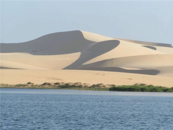
The Mui Ne to Bau Trang drive joins a fishing coast to white dunes and freshwater lakes. Follow the coastal corridor through Hon Rom and Suoi Nuoc before the road approaches the inland dune landscape. The excursion is distinctive because the sea does not remain the only subject: coastal settlements give way to broad sand slopes, and water reappears as lakes rather than ocean. It is a good choice for travelers who want a varied half-day excursion while keeping Mui Ne as their beach base.
Bau Ong and Bau Ba are the lake features to look for at Bau Trang. Sand divides the wider freshwater system into smaller and larger bodies of water, with dunes rising around them. Seasonal lotus flowers can add pink and green to that otherwise pale landscape. A short dune walk reveals the contrast between sand contours and the lake surface more clearly than a roadside photograph alone. Early or late light gives the dunes more visible shape and makes walking more comfortable. Quad-bike and jeep activities are separate options, so decide whether you want landscape time or a motorized excursion.
A Phan Thiet and Mui Ne gives this excursion a straightforward place in a longer holiday. Keep the same hotel and use one morning for the coast and dunes, leaving the afternoon for the beach or rest. Confirm pickup, stopping points and what is included before departure. The route works best as a contrasting local outing rather than another full transfer day.
7. Which Vung Tau roads give you an easy seaside circuit?
- Route: Tran Phu and Ha Long streets around the headland, continuing toward Thuy Van
- Best for: A short southern coastal excursion with town facilities
- Landscape: Waterfront streets, rocky slopes and open beaches
- Time to allow: Half a day with walks and refreshments
- Practical note: Combine driving with legal parking and short walks
Vung Tau’s coastal circuit shows how Front Beach and Back Beach sit on opposite sides of the town’s headland. Tran Phu and Ha Long streets follow the western waterfront and rocky coast, while Thuy Van opens onto the broader Back Beach setting. The route changes character within a short distance: sheltered urban seafront, slopes above the water and a more open sandy shoreline. Choose this drive when your group wants coastal scenery with cafes, short walks and town facilities close together.
Bach Dinh and the lighthouse add two different viewpoints to the circuit. Bach Dinh, also called the White Palace, occupies a wooded hillside above the Front Beach side and introduces the town’s colonial-era architecture. The white lighthouse stands on Small Mountain and requires a separate climb or uphill approach from the main shoreline route. The lighthouse view explains the shape of the peninsula; the waterfront drive shows its beaches and streets at ground level. Pick one additional visit if time is limited, leaving space to walk rather than turning every landmark into a compulsory stop.
Vung Tau can form a southern coastal stay after time in Ho Chi Minh City. The Vung Tau guide provides context for combining the shoreline with food and local attractions. Expect an active town rather than an empty resort strip, particularly around popular holiday periods. Allow the day to respond to traffic and weather. Travelers already spending several nights at a quieter beach may prefer this compact circuit over adding a second full day of coastal transfers.

8. Why extend a southern beach stay from Long Hai to Binh Chau?
- Route: Long Hai through the Loc An and Ho Tram corridor to Ho Coc and Binh Chau
- Best for: A beach extension from Ho Chi Minh City or Vung Tau
- Landscape: Fishing communities, resort beaches and coastal forest
- Time to allow: A full day or an overnight extension
- Practical note: Resort facilities and beach entrances may require separate permission or payment
The Long Hai to Binh Chau corridor combines fishing settlements, resort beaches and a surviving coastal forest. Travel through the Loc An and Ho Tram area toward Ho Coc, where the relationship between sand and wooded land becomes especially noticeable. This is the southern choice for visitors who want more than an urban seafront circuit. Its appeal lies in changing between inhabited coastline, a beach base and a forest-backed shore while keeping accommodation within one manageable coastal area.
Binh Chau-Phuoc Buu Nature Reserve distinguishes the eastern end from a conventional resort strip. The reserve protects natural forest close to the sea, adding a wooded landscape to the Ho Coc and Ho Tram beach setting. Binh Chau’s mineral-spring facilities offer a separate inland option for travelers who prefer bathing and relaxation to another beach stop. Neither a forest visit nor a hot-spring session is automatically part of the road transfer. Choose one beach pause and one additional experience, then use the drive to connect them at a relaxed pace.
For a trip crossing all three regions, this route works as a final overnight extension rather than another sightseeing checklist. Stay in one base and explore a manageable section from there. Check sea conditions before swimming, and do not assume that a quiet beach has lifeguards. If returning to Ho Chi Minh City for an international flight, leave a generous road buffer or return the previous day. The practical gain is a calmer finish to the journey, without having to add an island flight.

How should you plan coastal drives across a longer Vietnam trip?
Build the holiday around overnight bases, then choose coastal sections that connect them or add a worthwhile local excursion. A northern bay drive, one Central Vietnam transfer and a southern beach extension are enough to create variety. You do not need to follow the coast continuously between Hanoi and Ho Chi Minh City.
Ask the driver to confirm the actual route, stopping places and luggage arrangements before travel. Navigation software may favor a tunnel or inland highway. Keep exposed viewpoints flexible in poor visibility, and check local advice after heavy rain. Travelers who want sea views without driving can compare the country’s scenic train journeys in Vietnam for suitable daytime alternatives.
Plan Your Vietnam Trip with Paradise Travel
Paradise Travel is a licensed international tour operator and destination management company based in Hanoi. Established in 2005, the company organizes private, tailor-made journeys in Vietnam, Laos, Cambodia, Myanmar and Thailand. Paradise Travel has received Tripadvisor recognition in 2018, 2019 and 2024.
Explore our Vietnam discovery tours, Vietnam beach vacations and Central Vietnam tours, with private car rental with a driver available for suitable routes. A longer journey can connect northern bay scenery, Central Vietnam’s coastal headlands and a southern beach stay. Our team can build these sections into your travel dates and preferred pace, with realistic transfer days and time for stops.
Get in touch with our team to discuss your dates, interests and preferred pace, or create your own Vietnam holiday with local planning support.

Address: 81 Alley 12 Dao Tan Street, Giang Vo Ward, Hanoi, Vietnam
Hotline: 0989391076
Email: sales@vietnamparadisetravel.com
Frequently Asked Questions

Start planning your tailor-made Southeast Asia tour by contacting one of our specialists…
